Unveiling new products, innovative solutions, case studies, and industry updates
Enhancing Urban Traffic Signal Control with Camera-Integrated Radar Systems
1. Real-Time Traffic State Perception & Adaptive Signal Control
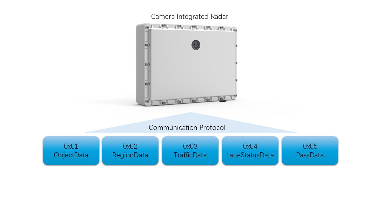
Target Trajectory Data (ObjectData) provides real-time position, speed, acceleration, and direction of each vehicle or object. This allows:
Adaptive signal timing: Signals can adjust in real-time based on traffic volume, speed, and queue length.
Congestion detection: Identify slow-moving or stopped vehicles to trigger signal changes.
Turning movement analysis: Understand vehicle paths for better phase design.
2. Traffic Flow Optimization
Traffic Flow Statistics (TrafficData) includes:
Vehicle counts per lane and type (car, bus, truck, etc.)
Average speed, headway, occupancy, and queue length
Benefits:
Optimize green time allocation per lane or direction.
Reduce idle time and unnecessary stops.
Improve intersection capacity and throughput.
3. Lane-Level Management and Prioritization
Lane Status Data (LaneStatusData) provides:
Queue length, head/tail position, number of queued vehicles
Real-time spacing, lead/trailing vehicle speed
Applications:
Dynamic lane assignment (e.g., bus or turning priority lanes).
Prevent lane overflow and spillback to upstream intersections.
Support variable message signs (VMS) for lane guidance.
4. Multi-Modal Traffic Support
Vehicle Type Classification (from both ObjectData and TrafficData) distinguishes:
Cars, buses, trucks, motorcycles, bicycles, and pedestrians
Use Cases:
Prioritize public transport or emergency vehicles.
Support pedestrian and cyclist phases in signal plans.
Enable eco-traffic management by influencing heavy vehicle routing.
5. Intersection Performance Monitoring
Regional Statistical Data (RegionData) offers:
Turning movement percentages (left, straight, right)
Direction-based traffic distribution
Benefits:
Fine-tune signal phases and cycle lengths.
Evaluate intersection efficiency and identify bottlenecks.
6. Real-Time Incident and Anomaly Detection
Target Data includes:
Abnormal speed, sudden stops, wrong-way movement
Parking status detection (illegal parking)
Response:
Trigger alerts for traffic management centers.
Adjust signals to mitigate incident impact.
7. Data-Driven Planning and Simulation
Historical Traffic Data (aggregated from real-time feeds) supports:
Signal timing optimization using historical patterns.
Simulation modeling for future infrastructure changes.
Performance indicators: delay, stops, travel time, emissions.
8. Enhanced Coordination Between Intersections
Vehicle Trajectory and Speed Data enables:
Green wave coordination: Synchronize signals for platoons of vehicles.
Network-level optimization: Use vehicle paths across multiple intersections to improve corridor performance.
9. Support for Smart City and V2X Applications
High-precision location data (latitude/longitude with 1e-7° resolution) can be used for:
Vehicle-to-Infrastructure (V2I) communication.
Predictive signal control for connected and automated vehicles (CAVs).
Summary of Key Benefits:
✅ Reduced delays and stops
✅ Improved traffic flow and intersection capacity
✅ Enhanced safety through real-time monitoring
✅ Better support for multi-modal transport
✅ Data-rich foundation for AI-based signal control systems
✅ Scalable and integrable with existing traffic management systems
By leveraging these rich data streams from ClairWav radars, cities can move from fixed-time signal plans to dynamic, responsive, and efficient traffic control—paving the way for smarter, safer, and more sustainable urban mobility.