News
Unveiling new products, innovative solutions, case studies, and industry updates
2026.07.24
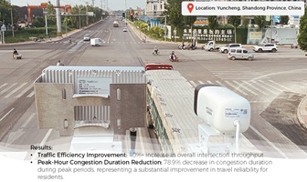
ClairWav Radar Application Case Study: Dynamic Green Wave Traffic Control in Yuncheng County
In recent years, Yuncheng County has faced increasing traffic pressure due to the intertwined development of old and new urban areas. With hospitals, schools, residential communities, and commercial establishments concentrated in the area, major roads and key intersections frequently experienced severe congestion, significantly impacting residents' daily travel and the city's overall development. The local traffic management authority sought an intelligent solution to address these challenges.
Learn more
2026.07.20
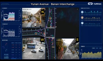
Radar-Powered Smart Traffic: Breaking the Gridlock at Chongqing’s Banan Interchange
The successful implementation at Banan Interchange has effectively unblocked the critical bottleneck where highway networks meet urban streets. By demonstrating how radar-based, real-time coordination can deliver tangible improvements, this project offers a replicable and scalable blueprint for managing highway-urban interchange congestion across China and beyond.
Learn more
2026.07.13
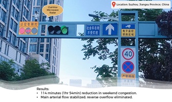
ClairWav Radar Cuts Weekend Congestion by 114 Minutes at Suzhou Train Station
Application Case Study: ClairWav Microwave Radar for Train Station Traffic Optimization Location: Suzhou, Jiangsu Province, China
Learn more
2026.06.08
Chain Communication Principle for 2.4GHz Mesh Networks of Solar Studs
Chain communication turns a group of individually sensing road studs into a collaborative real time system. Devices share local decisions with neighbors every 20ms, and each stud computes its own output based on combined local and adjacent information. The entire network continuously refreshes its state at 50 Hz, meeting the stringent latency requirements of vehicle proximity detection and dynamic lighting control.
Learn more
2026.05.26
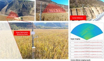
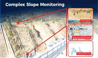
Case Study: Yan’an Slope Stability Monitoring Pilot Project
The Yan’an region, characterized by mountainous loess terrain, faces significant slope stability challenges due to natural and anthropogenic factors. The project area is dominated by thick loess coverage with well-developed gullies and vegetation cover below 40%. The rainy season brings frequent and intense rainstorms, which easily generate surface floods carrying large amounts of sediment, resulting in severe soil erosion. Poorly developed drainage systems on slopes lead to inadequate water runoff, allowing rainwater to impact slope surfaces and cause loess caves, subgrade settlement, and other instability issues, posing major safety risks to slope stability. To enhance early warning capabilities and ensure public safety, a pilot slope stability monitoring project was conducted using advanced radar technology. The primary objective was to achieve high-precision, real-time monitoring of surface displacement and environmental parameters.
Learn more
2026.05.18
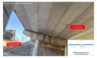
Introducing the ClairWav-BH10 Bridge Health Monitoring Radar
Bridges are critical infrastructure but keeping them safe across changing environments is a constant challenge. We’re proud to introduce the ClairWav-BH10, a smart, millimeter-wave radar solution designed for continuous, real-time bridge monitoring.
Learn more
2026.05.11
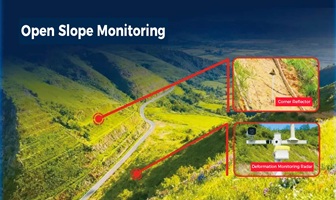
Keep Slopes & Dams in Check with ClairWav-SD1K – Millimeter Precision, All-Weather Reliability
Landslides, collapses, and dam failures can happen in seconds, but the warning signs often appear long before. The challenge? Detecting those millimeter-level changes across vast, complex terrain—in rain, fog, or darkness.
Learn more
2026.05.06
ClairWav-MD10 Micro-displacement Monitoring Radar – Real-Time Slope Stability for Safer Roads
Landslides, slope failures, and dam deformations can happen without warning—but the ClairWav-MD10 helps you stay ahead. This next-gen phased array radar delivers millimeter-wave precision to capture micro-displacement changes on slopes, mountains, mines, and dams. Deployed roadside along expressways (every 25–35m), it monitors both upper and lower slopes with upward/downward-facing units.
Learn more
2026.04.27
TraffiClair Radar Safeguards All-Weather Smart Mobility on the G15 Shenyang–Haikou Expressway
As a major transportation artery connecting China’s eastern coastal region, the G15 Shenyang–Haikou Expressway (Shenhai Expressway) plays a critical role in cross-regional traffic networks. Recently, TraffiClair deployed its all-scenario intelligent perception system along the Shenhai Expressway, leveraging advanced radar technology to establish a high-precision, all-weather traffic detection network—fully empowering the expressway’s digital transformation.
Learn more
2026.04.14
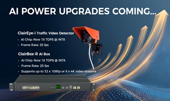
18 TOPS of AI Power: Major Upgrades for ClairEye-I Traffic Video Detector & ClairBox-R AI Box
We’ve significantly upgraded both our ClairEye iSeries and ClairBox-R — bringing more processing power, higher frame rates, and smarter software features to urban traffic management.
Learn more
2026.03.10
Case Study: TraffiClair Camera-integrated Radars Improves Traffic Efficiency on Nansha Bridge
At the beginning of 2025, TraffiClair’s Radar-Vision Integrated Traffic Sensor was deployed on the Nansha Bridge in Guangzhou, providing precise real-time traffic data for a digital expressway capacity-expansion project. The Nansha Bridge connects Guangzhou Nansha District and Dongguan, serving as a critical cross-river corridor in the Guangdong–Hong Kong–Macao Greater Bay Area, where traffic volumes surge during peak travel periods such as the Spring Festival travel rush.
Learn more
2026.03.10
Illuminating the path to zero accidents: Introducing the ClairSaf-LumaLane.
At TraffiClair, we believe that visibility is the first line of defense in traffic safety. We are thrilled to officially unveil the LumaLane Zebra Projector—a leap forward in pedestrian crossing technology designed for the demands of modern infrastructure.
Learn more
1 2 3 4 5  ... 8
Please fill in the form to signup for the newsletter.